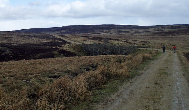
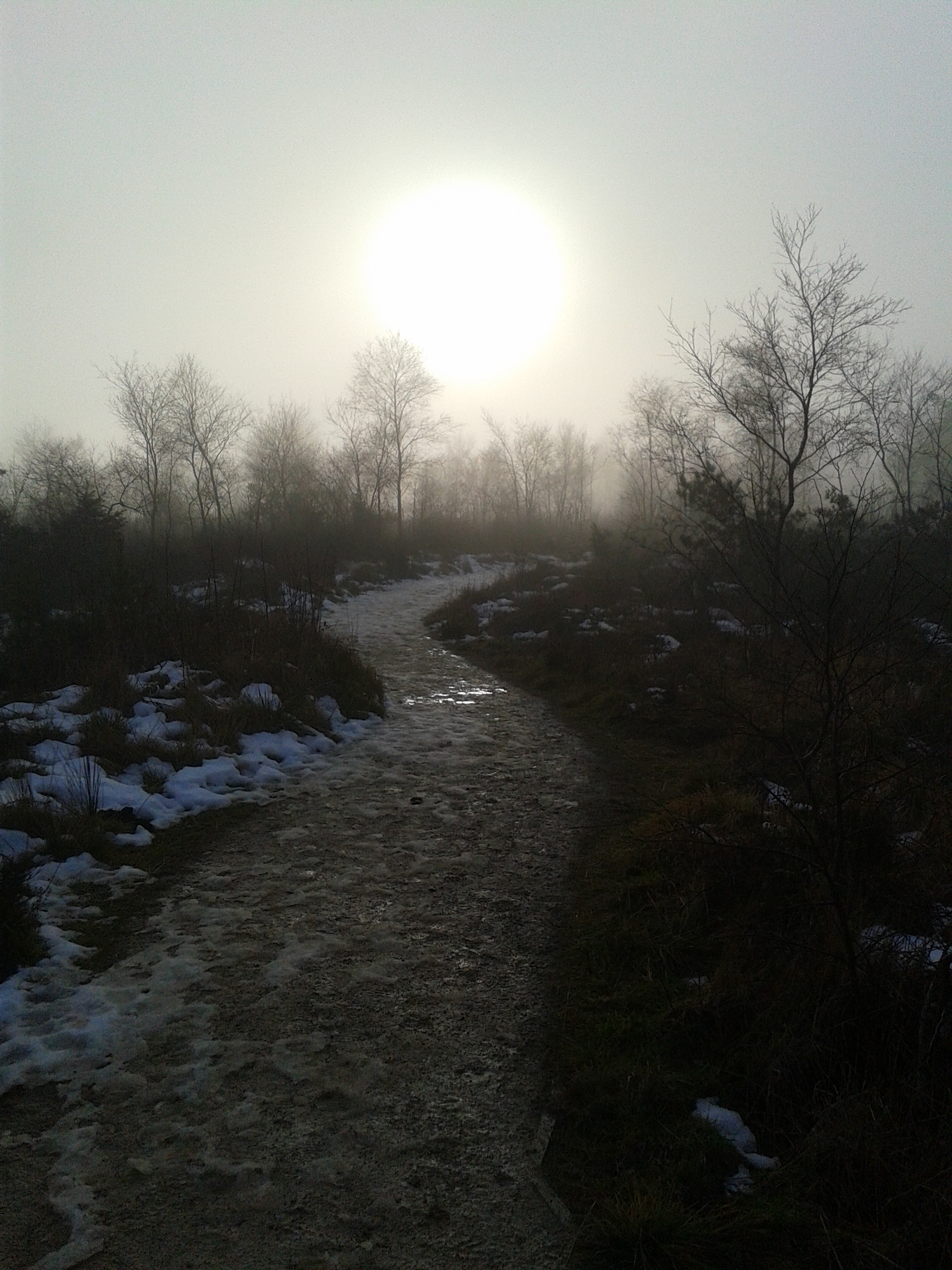
I have been doing the Allendale a fair few years now, and it is as it says a challenge as much as a run. I had set myself a target of running without stop until the road turned to rocky path on the uphill from Ninebanks and I am pleased to say I managed this without too much difficulty. Onwards and up onto the moors where you always forget quite how squelchy and soft the bogs are until you are actually trying to run across them again. I must admit I was fairly feeble and ran less than I should/could have done but I soon got to Black Hill checkpoint where I was revived by a nice cup of tea, enjoying the short lived relief from the howling wind that the refreshment tent provided. The route over to Killhope seemed much boggier than usual and I pretty much fell in line with the snake of walkers apart from several intense “scuttle runs” that allowed me to overtake here and there.
After Killhope I ran the vast majority of the rest including the drag where I had an little internal conversation with myself “Why not walk this bit it’s not going to matter, No if you don’t run the drag then you are not going to go to the Fling that is final. But I really want to do the fling though… Well then, just run up the drag and don’t stop” So up and up and along the drag I went and though it was not much more than a shuffle it was a least good to have some rhythm on a fairly even surface and I knew that I was keeping going when the majority of other runners (I was with) had given in and this I suppose is the difference between the ultrarunner and the “out for a few hours” type fellrunner.
In other words I had the edge as far as mental strength went ! I carried on to the end, finishing feeling less tired than I have ever done before, though my extra weight meant that I was an 1hr 17 mins outside my personal best crossing the threshold of Allendale village hall in 6hr 13 mins. Quite pleased and though my right knee particularly on any stretches with hard surfaces was quite painful, the pain always seemed transitory rather than indicative of permanent damage. A good result though a reminder of how my natural pace has dropped compared to what it used to be.
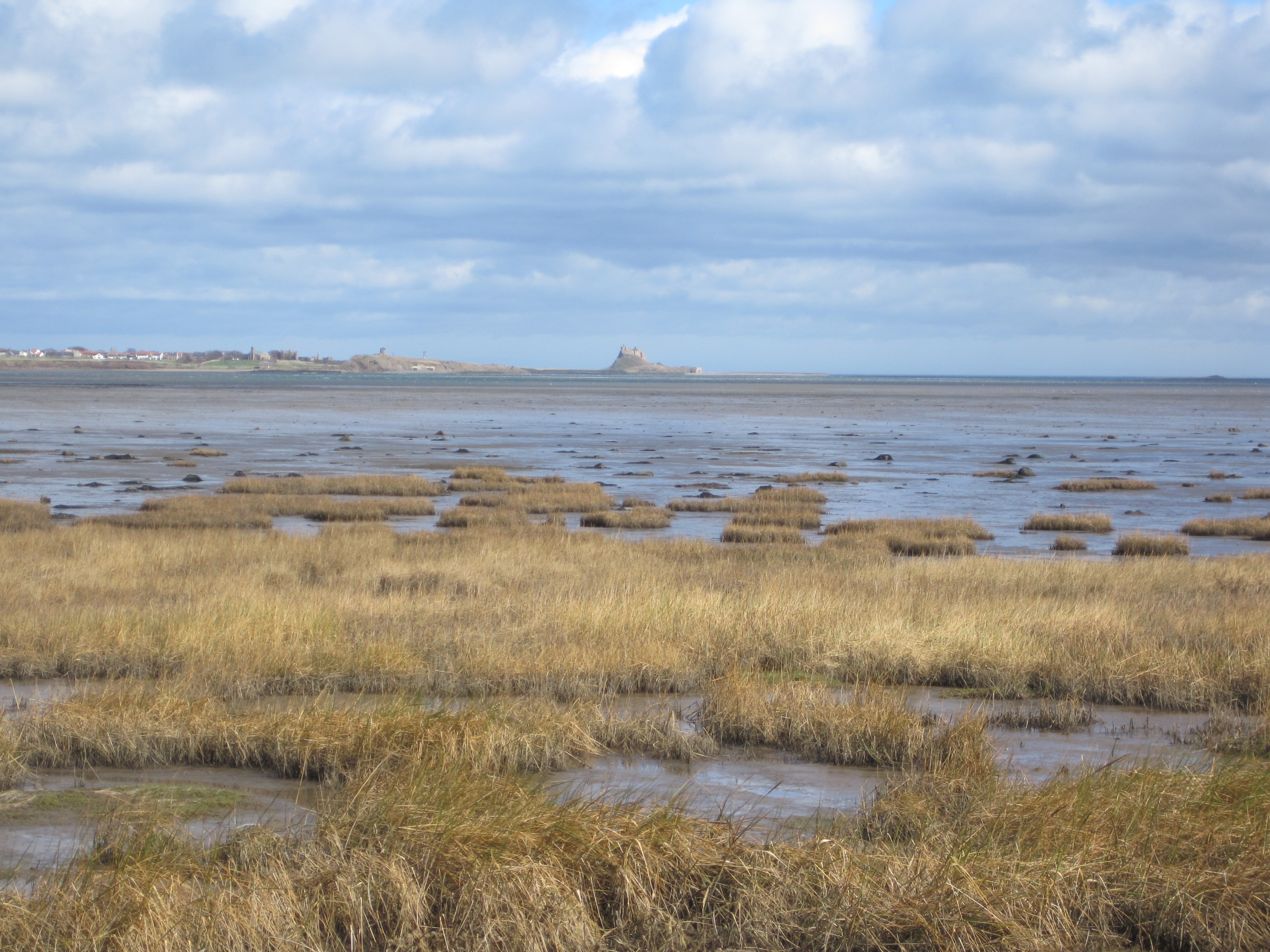
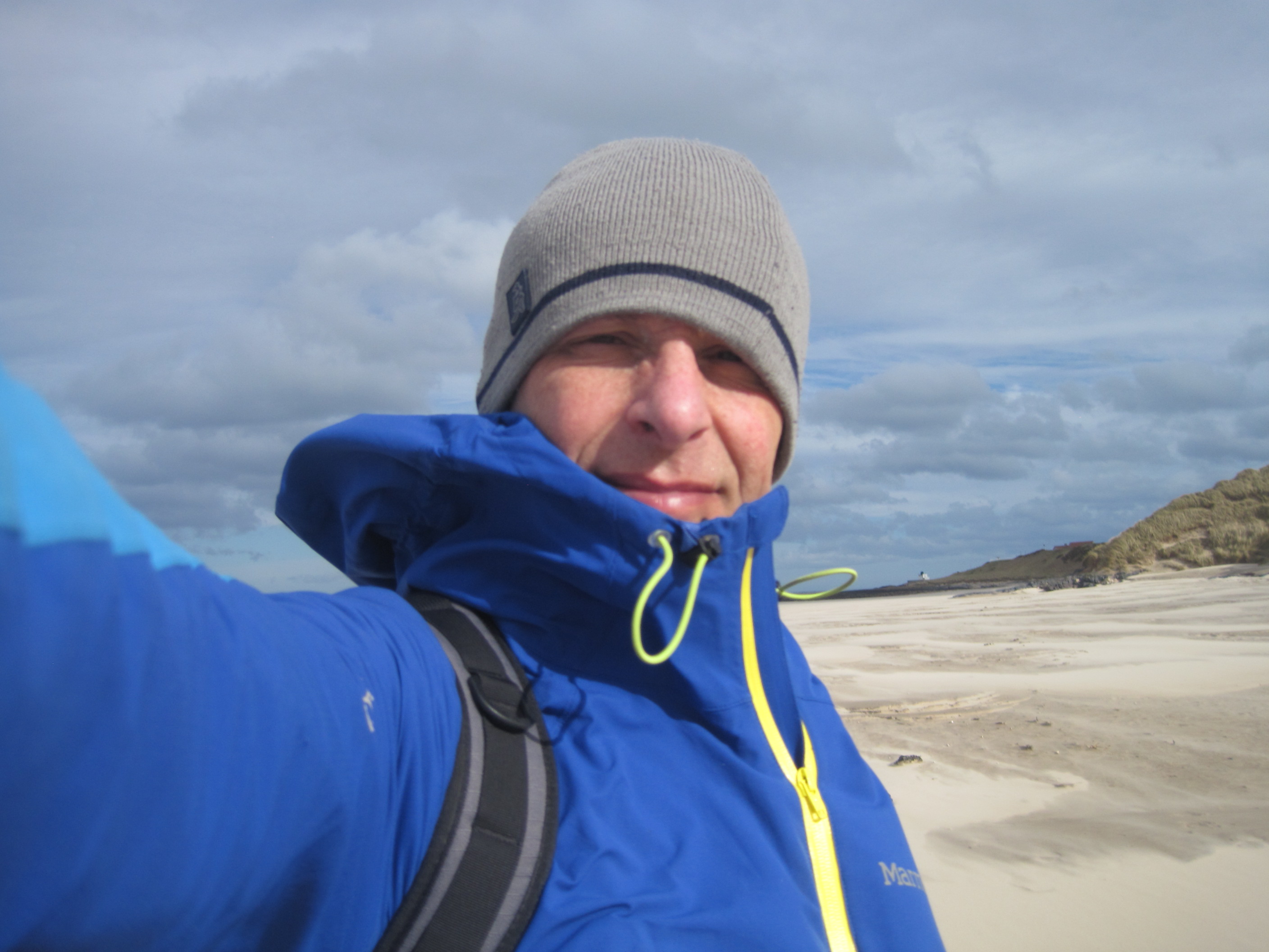
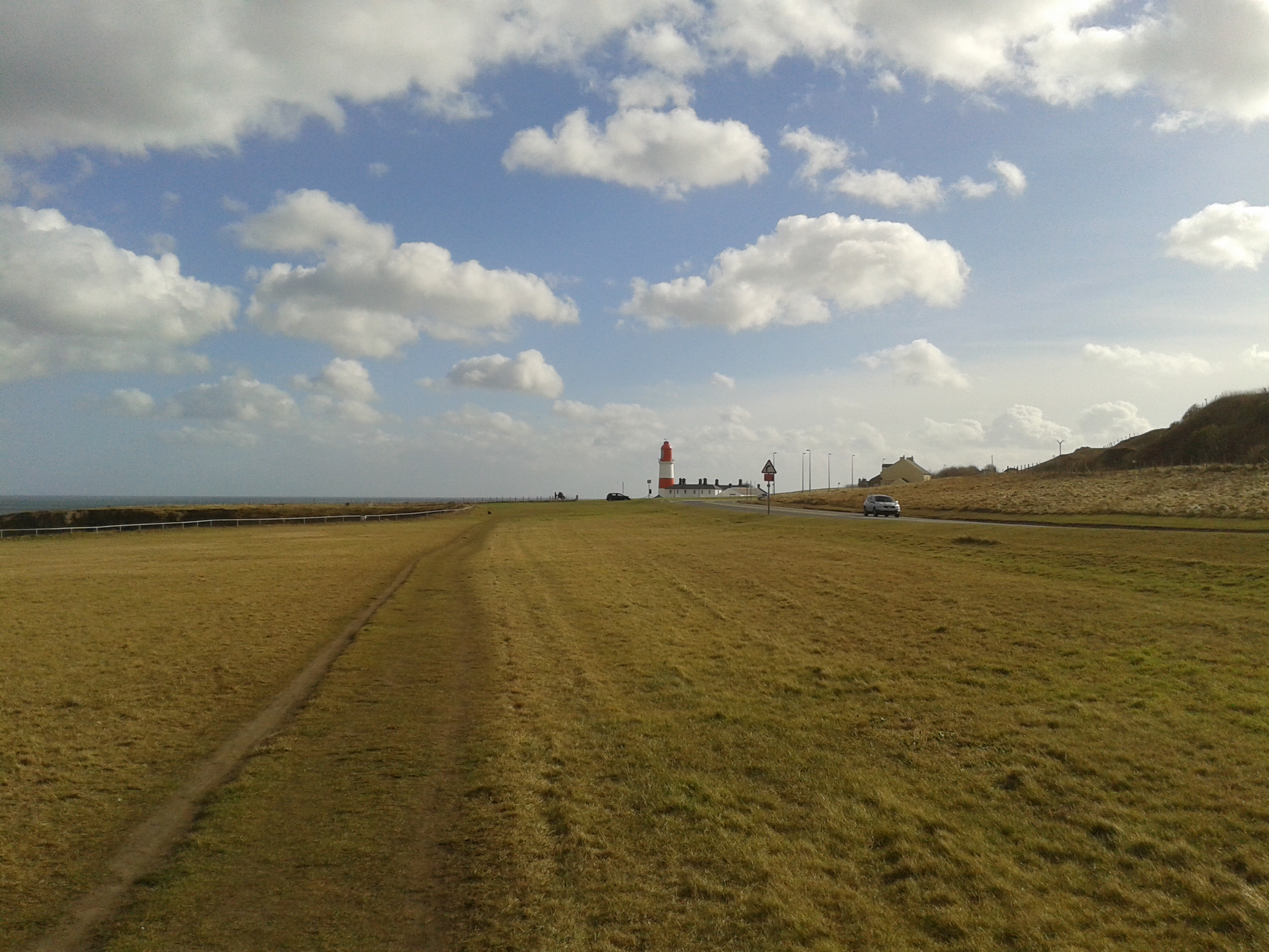
It was time for my big run, as part of my training for the Hoka Highland Fling, 35 miles or so following the gloriously scenic Northumberland coast. It looked a superb route and I was really looking forward to the section from Holy Island causeway down to Bamburgh. The St Oswald’s way headed well inland over hills beyond the A1 at this point and there must be a path following the coast I thought, despite nothing being marked on the map, so it would just be a matter of following my nose with the chance to use my OS Map App bluetoothed to a state of the art Garmin GPS Reciever for the first time in earnest.
Things immediately failed to go to plan as I got on the 7.38 to Berwick only to hear the train guard say welcome to the Virgin Cross Country train to Southampton ! After (rather sheepishly) having to explain my mistake to more than a few station/train personnel I eventually arrived at Berwick a little over an hour after I had decanted at Durham. This prompted a little twinge of anxiety as I knew the last train to Newcastle from Alnmouth was at 18.58 so I didn’t have huge amounts of spare time to fanny about.
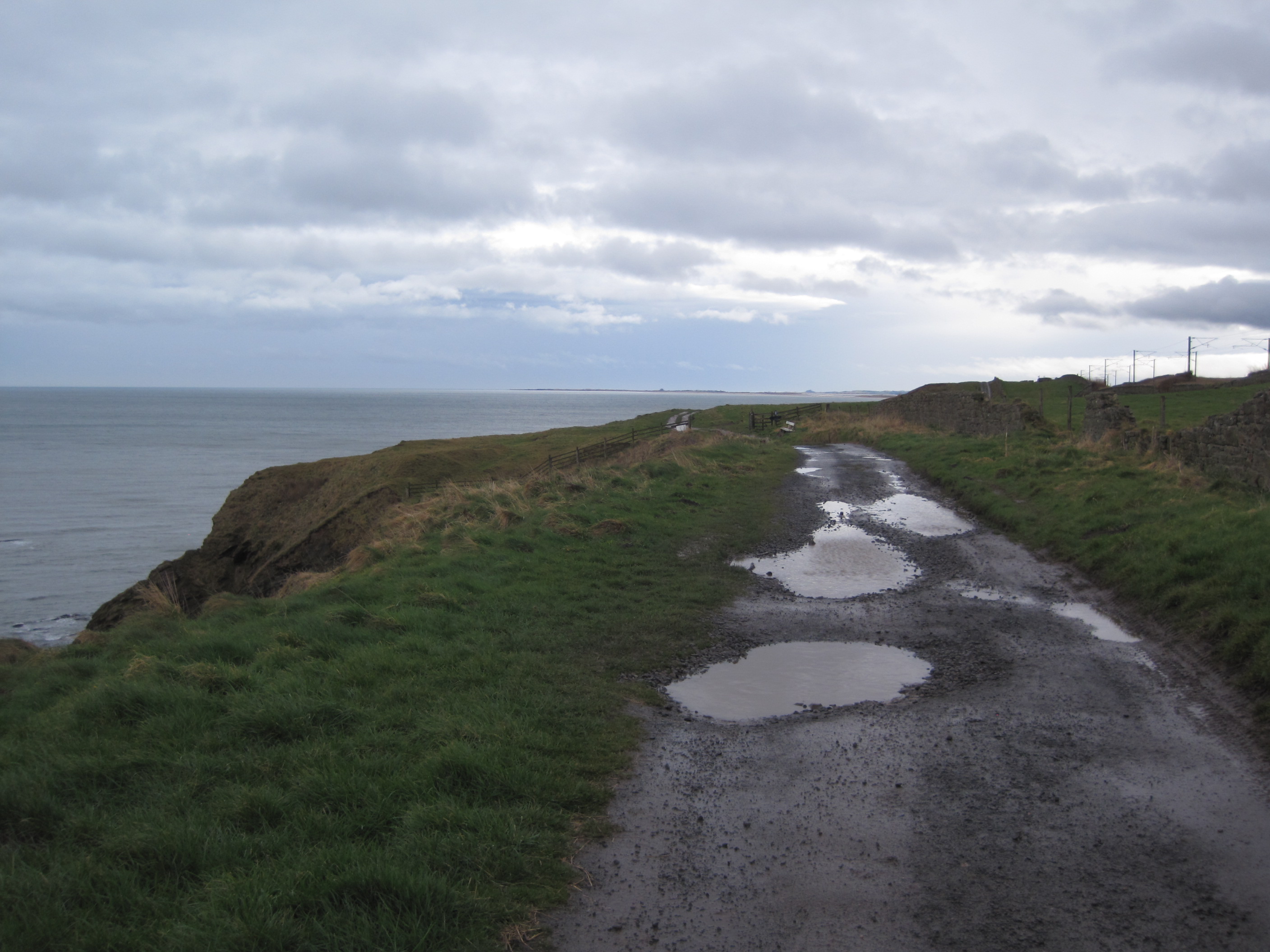
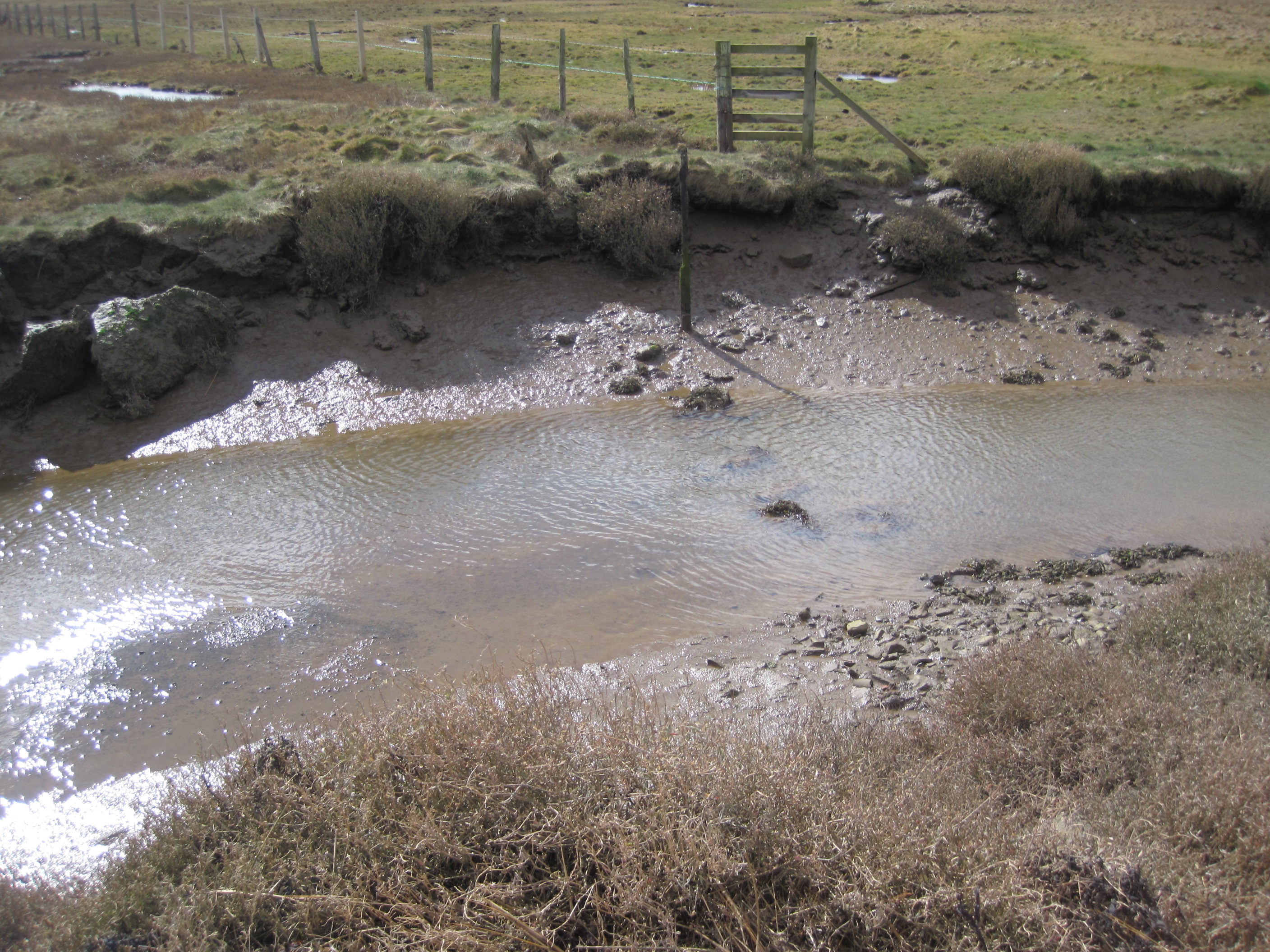
Steady rain was falling as I started my run over old berwick bridge and worked my way along to spittal and the Northumberland coastal path. Things got increasingly scenic though hardly tranquil as the main east coast line absolutely hugged the coast at this point. Slowly the sky began to clear and I could see Holy Island and Bamburgh castles as small blobs on the horizon and I started to really feel as if I was on an epic journey across the landscape. I was feeling really good and once past Holy island causeway I started my quest into the unknown as I attempted to follow the coastline south. Things went pearshaped fairly quicky though. Huge tussocks replaced any discernable path and then I hit the first of many muddy creeks that dissected the landscape. Up and down looking for places to cross without getting stuck up to my neck I went. This seemed to go on for ever but eventually I got back to reasonably dry land. Knackered ! The next section was lumpy and wet as I traversed the shoreline of Lindisfarne nature reserve, with the sun really starting to beat down at this point. I had a bit of a walk eating my sandwiches and stuffing in some trailmix hoping that I would soon feel better, I didn’t until I finally ate a bag of crisps and almost immediately felt fine. I carried on attemping to run but there was no path as such and it was tiring. Eventually I came to a point where a road intersected the coastline and I decided enough was enough and it was time to take an alternative route.
My Phone and Garmin Reciever worked superbly with my position pinpointed onto a downloaded 1:25k map pretty much instantaneously. The only trouble was that I was losing about 1% of my battery for every 1 minute of use not really what you need for an all dayer out in the sticks.
Much of the next section was totally forgettable as I tried to follow sections of public footpath, getting lost and spending hours running along tarmaced roads, not exactly how I had envisaged things. I eventually circumnavigated Budle Bay and was finally able to enjoy the terrain as I headed up the beach eventually getting into Bamburgh around 3.30pm. 22 Miles.
My plan of getting to Alnmouth and catching the train was in tatters as it was almost the same mileage away again and I didn’t have a clue about the transport options on route. Psychologically I was defeated and so I gave up and tramped around Bamburgh looking for a bus stop. It turned out there was a bus in just over an hour and so even though I could easily have run down to Beadnell or at least Seahouses I didn’t and decided to go to the pub instead. With a minimum spend of £10.00 on a card I managed to force down 3 pints before getting on a bus to Alnwick that pulled in shortly before 6pm. At least there was a connecting bus down to newcastle leaving at 18.12 though it was near enough a two hour trip ! I headed into the next door Morrisons getting a sandwich, 4 mini bottles of red wine and a paper to ease the tedium of my journey. Finally back home to South Shields for 9pm. Feeling more than a little deflated through the haze of alcohol.
The Old Bridge at Berwick-Upon-TweedStart of the route proper, Bamburgh and Holy island castles small blobs on the horizonTroubleScenic trouble thoughBamburgh around the corner !
After a weekend of no runs at all due to family commitments (mother’s day etc) I was determined to fit in a run at the next available opportunity. I was down in London on Monday and thought there might be just enough time to squeeze in a run before getting the train back, so I packed my running stuff in with the rest of my gear. Once out of the meeting I headed straight back to Kings Cross changed in the loos, dropped my bag at left luggage and then headed up Euston Road and into Regent’s Park. It was noticeable how totally unphased the park wildlife – ducks, geese, squirrels etc were even when running right alongside. Half way around Regent’s Park I diverted up onto Primrose Hill. Though it was hardly Conic Hill in scale and in fact was much more reminiscent of Cow Hill on Newcastle’s Town Moor which is my regular place for an after work run. There were lots of tall buildings visible from the top but it was so grey and clagged in that it was hardly worth a picture (though my phone had ran out of juice anyway). I traversed the back side of Primrose Hill and then returned to complete my circuit of Regents Park. Next an unpleasant and somewhat dangerous section along the busy commuter choked pavements of Baker Street and Edgware Road to Marble Arch and Hyde Park. I was looking forward to the specially formatted bridleways for horses that run the length of the park but found in reality that they were composed of hard compacted sand, very lumpy and generally unpleasant to run on so stuck to grass wherever possible. After the long haul up to Kensington Palace it was back down again towards Hyde Park Corner and in the gathering gloom I headed past Buckingham Palace and into St James’ Park running past horse guards parade (rendevous point after the London Marathon). Finally it was down the Mall and into Green Park coming to a halt outside Green Park tube. It was nearly dark by this time and I didn’t have a lot of time to spare so it was straight into the tube station without any cool down/stretch only to find myself walking like a duck as my right foot started to cramp going down the escalators. I Picked up my luggage and got onto the 19.00 train back with about 5 minutes to spare. 10.22 miles
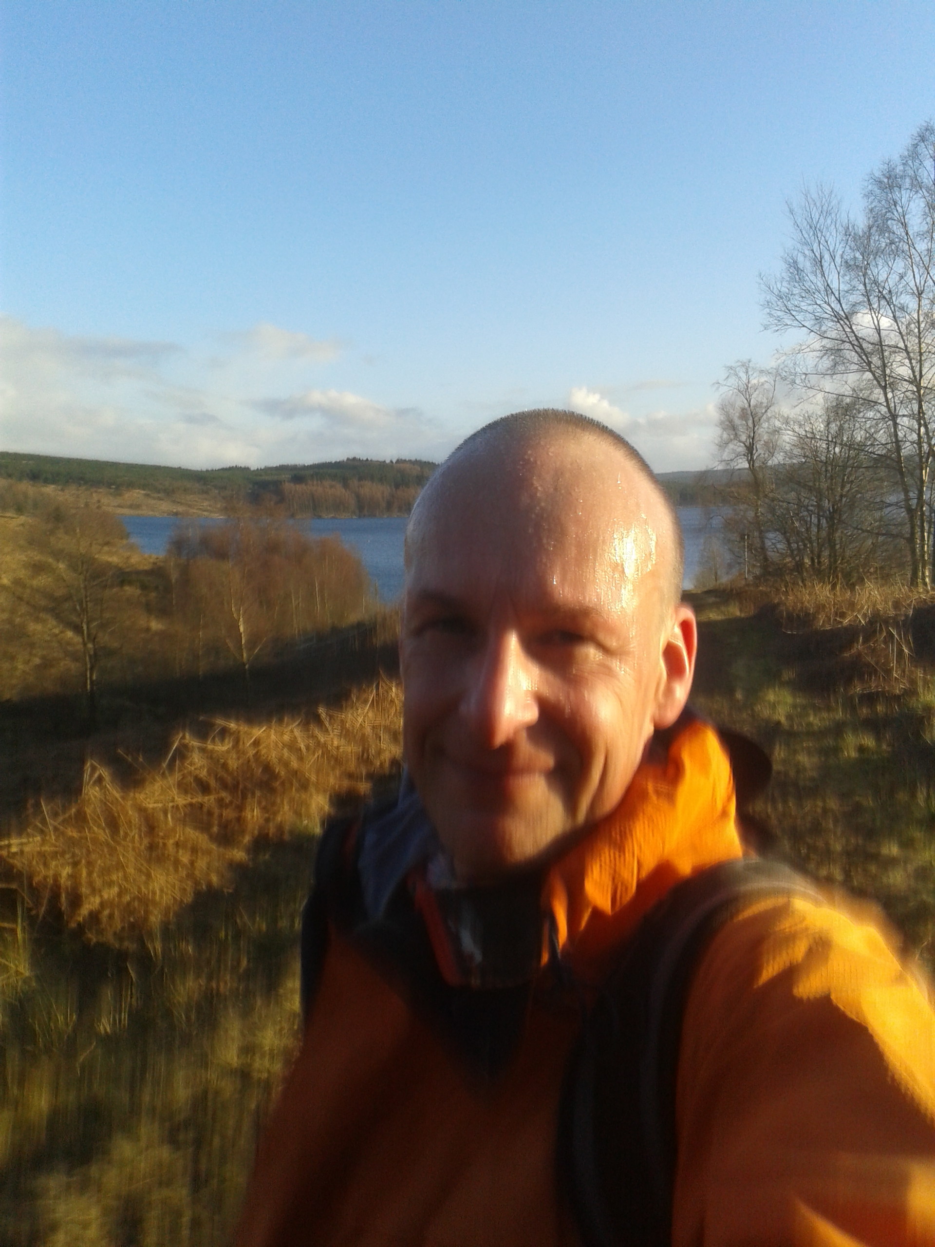
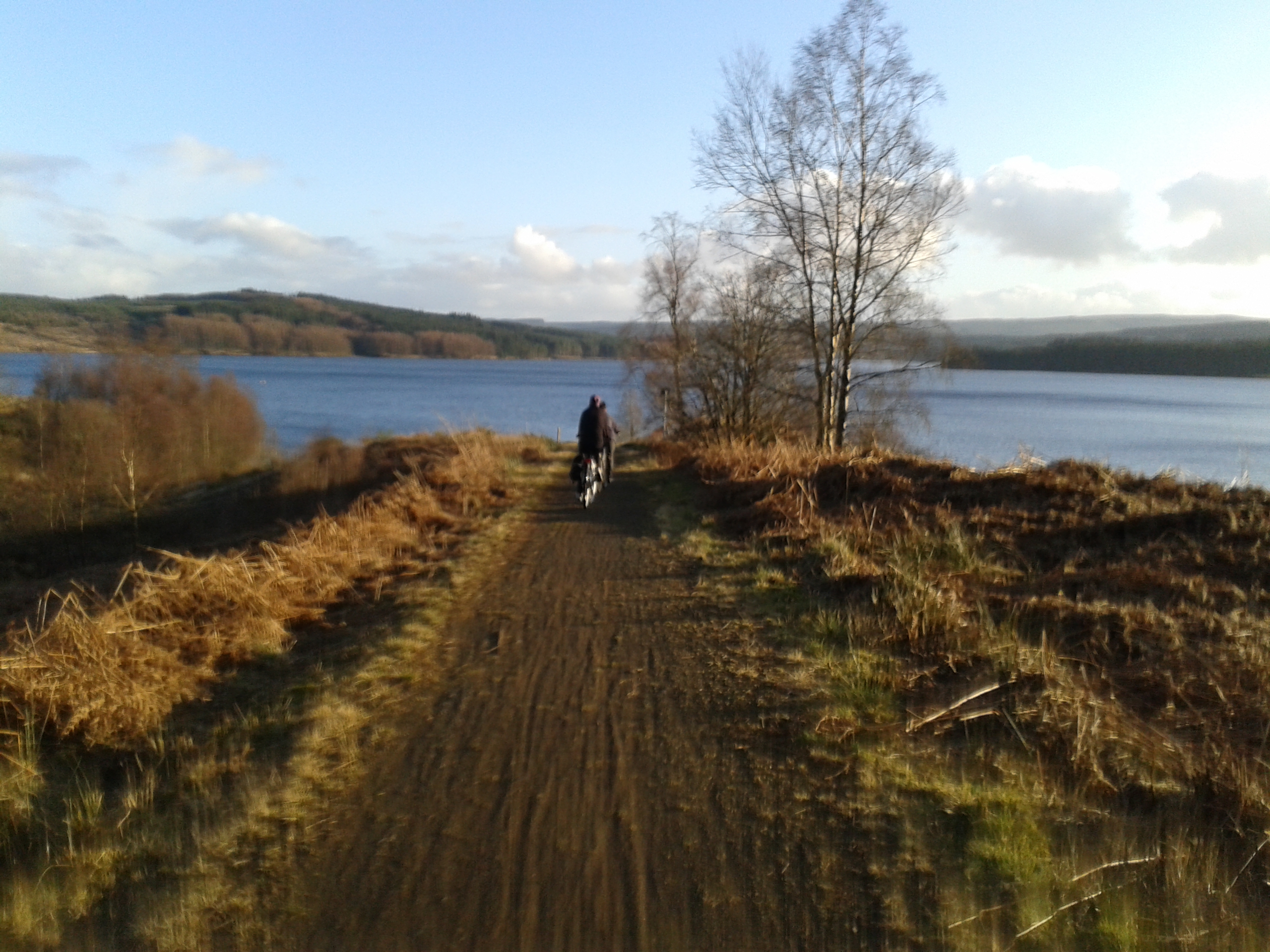
Time to be upping the mileage a bit more if I am to have a decent chance at the Hoka Highland Fling at the end of April, so it was up to Kielder Reservoir this Sunday.
Kielder is fantastic for me, not so much for the setting and the views (which are fantastic) but for the nature of the trail which is nice and soft and very forgiving on the knees. The Kielder circumnavigation is also perfect for bicycles which meant the rest of the family could accompany me too.
Starting from the Dam we proceeded in a clockwise direction, following the Lakeside route in its entirety apart from cutting over the big peninsular that jutts out after Tower Knowe so as to reduce the total mileage to something that would be manageable. I felt a step up in my ability today as I am nearly down to 12 stone which about 2 or 3 years ago was the limit for me running at all. I had springs in my legs on all the uphills (of which there were more than a few) and despite tiring towards the end, really felt fine and muscles and fueling all felt in sync. I had a large bowl of curried chicken with onions and avocado for breakfast and then only needed one gluten free nakd bar all the way around. Very pleased with how I got on and particularly the knees which were fine. 23 Miles.
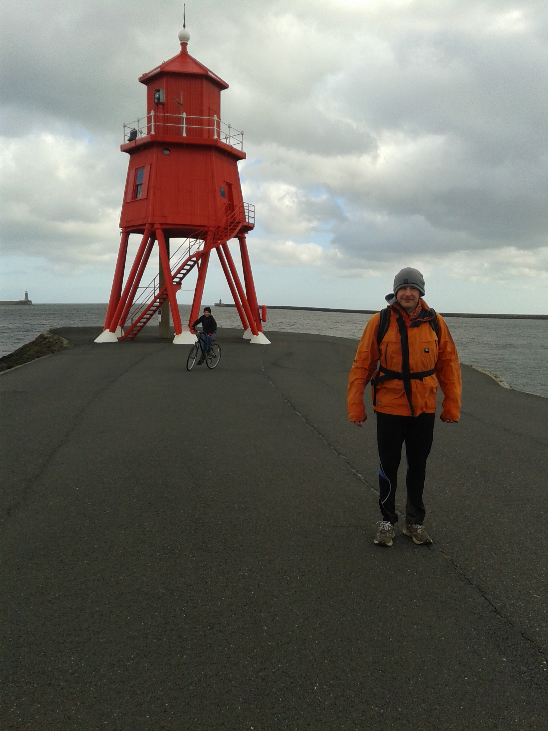
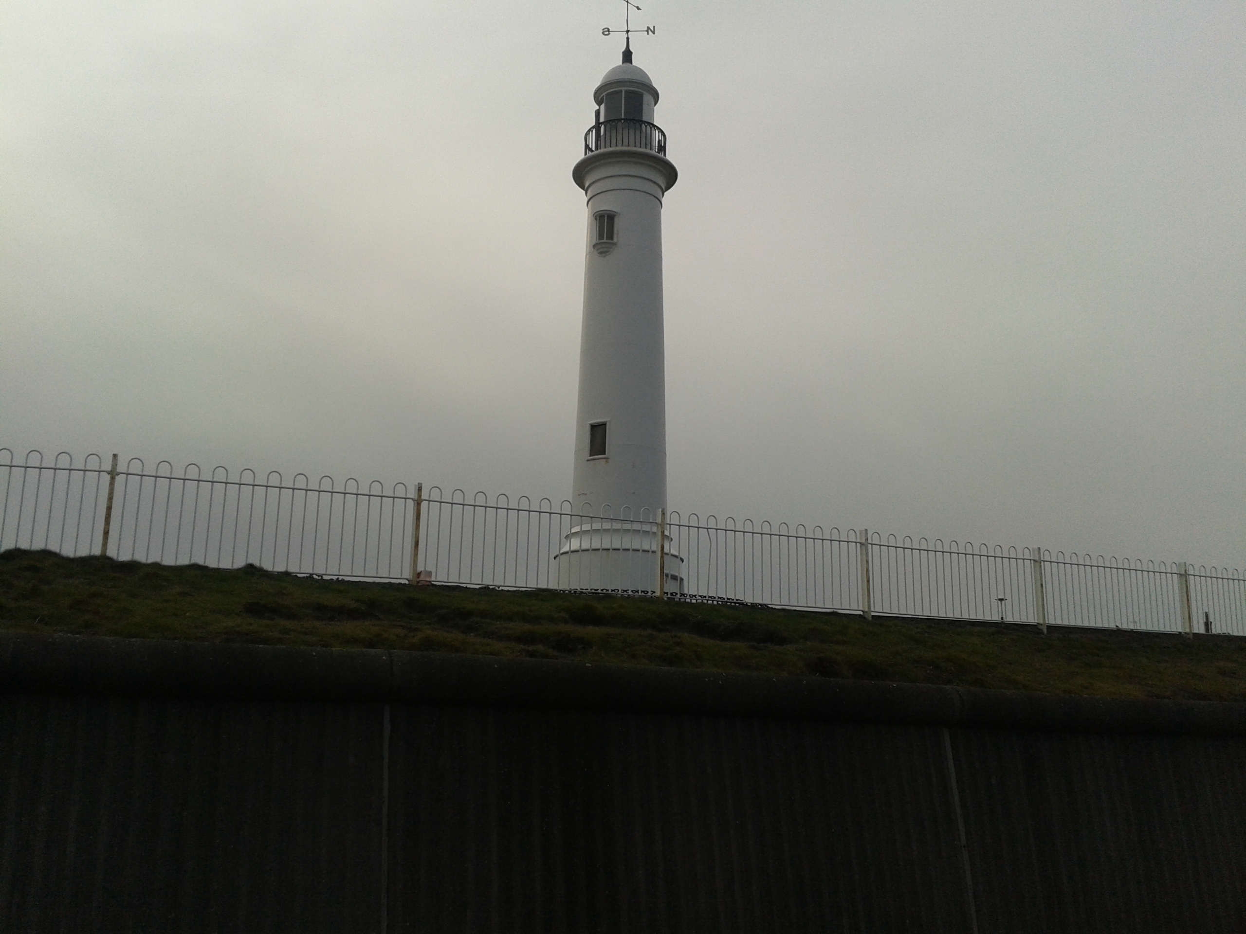
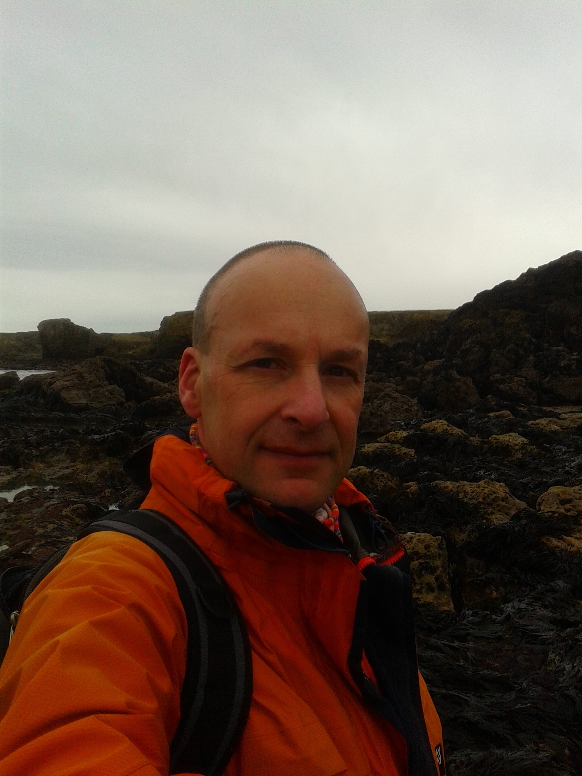
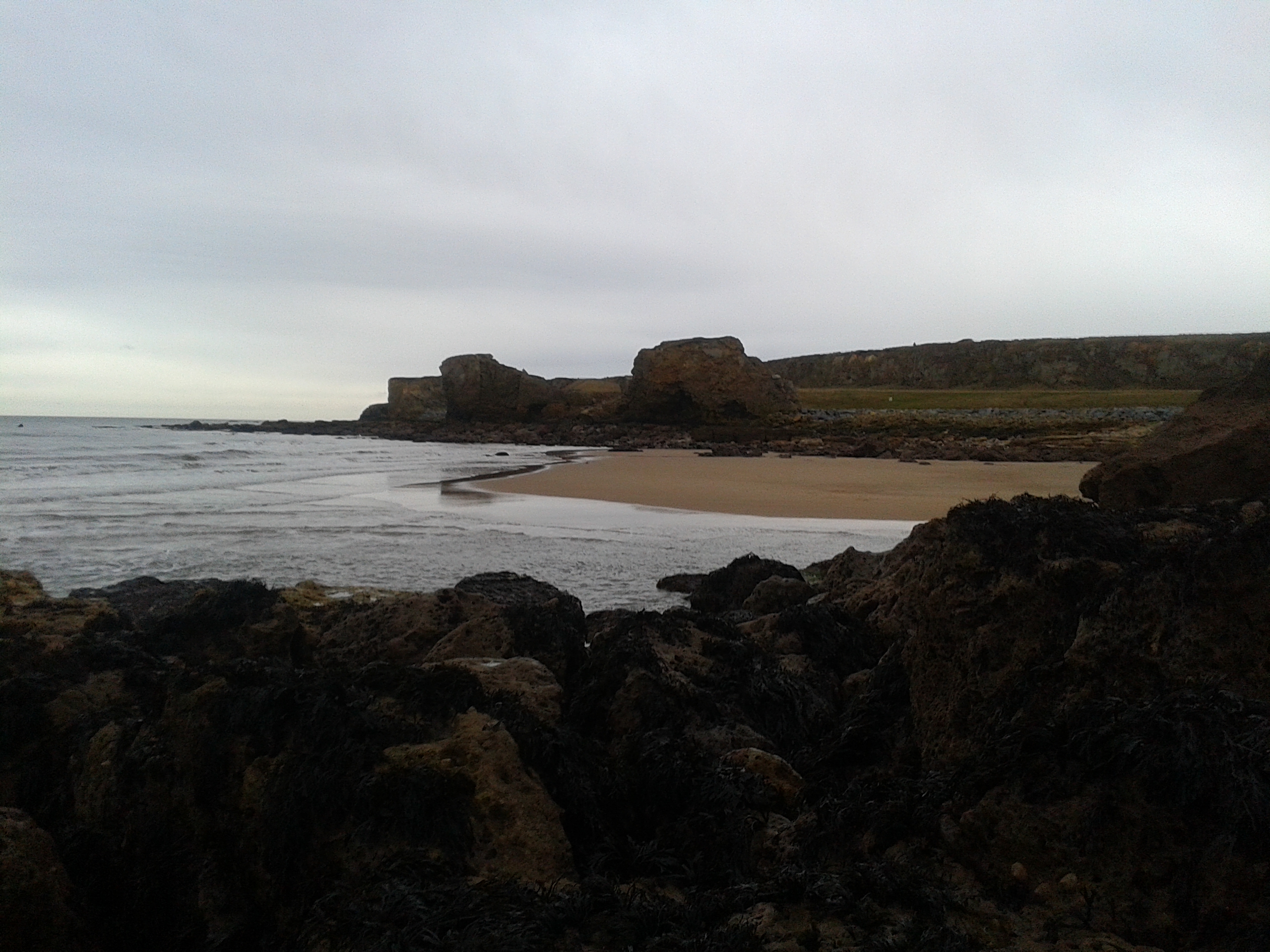
High winds, cold and general apathy meant that a planned trip up to Kielder did not go ahead and so it was my local coastal strip that was the venue for todays longer run. It is a lovely coastline but for someone who still shys away from running on pavement there is only about a 5 mile section that can be done on trails, never mind I thought I will just have to take it easy. First stop was The Groyne at the mouth of the Tyne, an attempt to run down to the end of Shield’s main pier was thwarted as the gates were shut, so it was on up the coast to Souter lighthouse, round the point, past Seaburn lighthouse and then finally along to Roker Pier in Sunderland which was also closed off. I returned along the same route. This was a run where getting fuel to my muscles was not a problem at all (a result of the mini carb. binge on Friday night ?) knee and calf pain was evident throughout though which I had to distract myself from and meant I adopted a scooting technique on the off-trail sections. Definitely some soreness in the MCL area of my right knee this evening which I shall have to be careful of. 17.22 miles
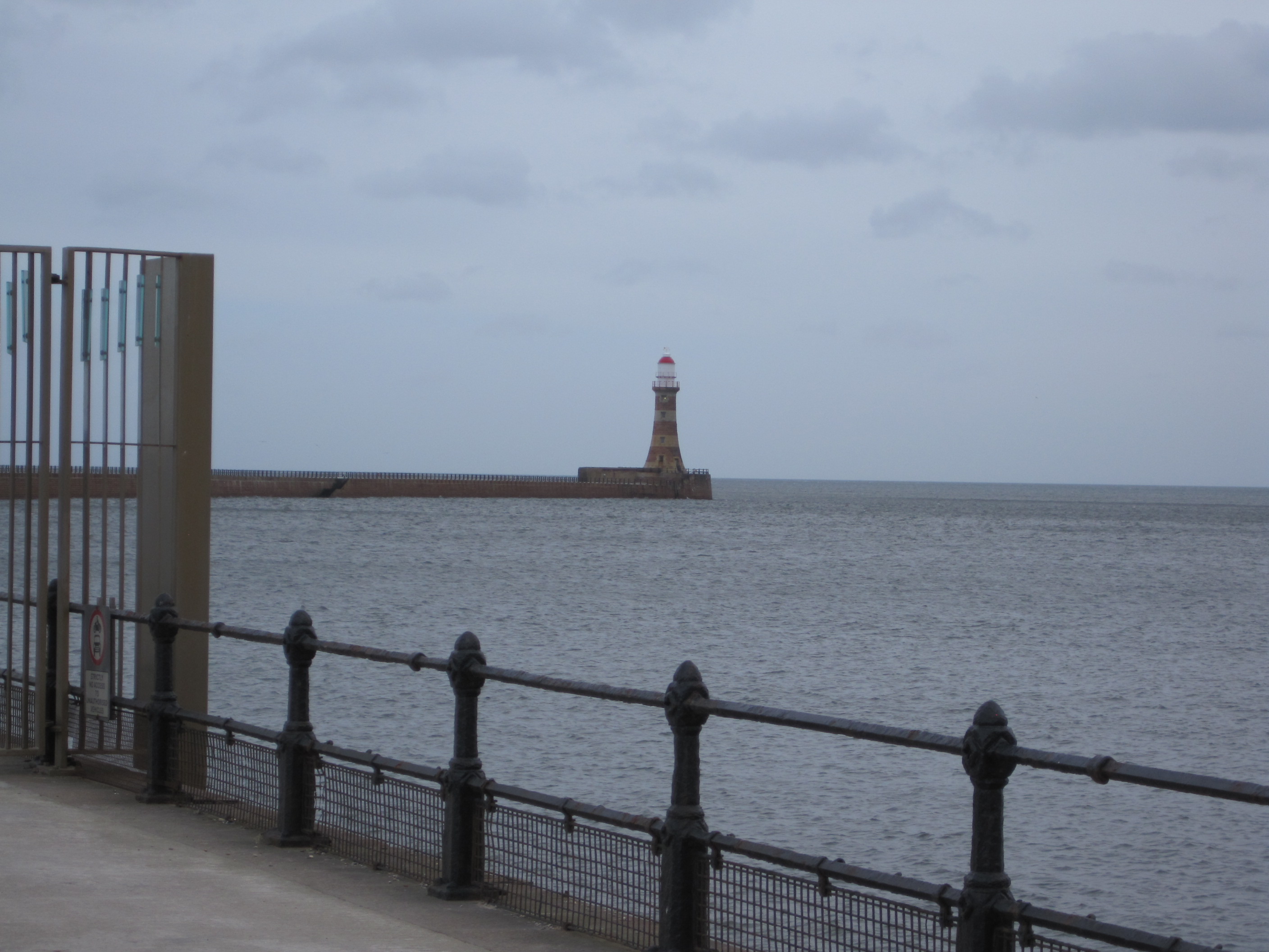
The Groyne, Mouth of the TyneOn the way to Souter LighthouseSeaburn LighthouseRoker Pier, Wearmouth
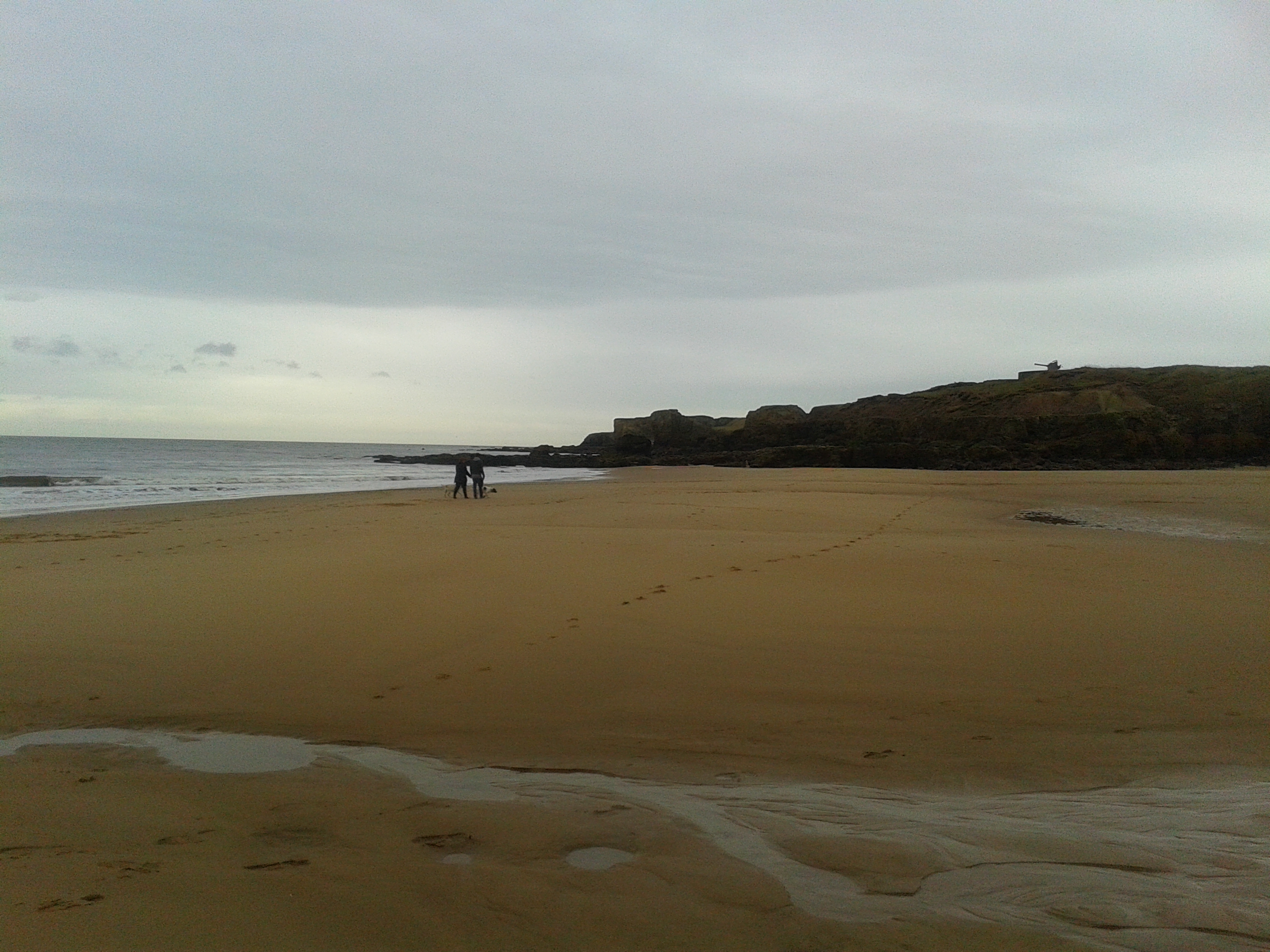
After a run on Tuesday up to Souter Lighthouse and back it was time for another as I start to crank up (very slowly) my weekly mileage. I live right next to the beach but unless the tide is right out then you have to run on a slope and my knees give me gyp so I tend to give it a miss. I did on the off chance decide to check last night and as luck would have it Low Tide was at 09.23. So it was a quick (250yd) walk down to where South Shields pier met the beach and off I went. Being on the beach at low tide always has a slightly ethereal quality to it. You are that much further away from all the touristy beach side paraphernalia and there are all sorts of channels and sandbars to navigate around. As one comes up to the headland there is also the opportunity to head in front of the cliffs over the seaweed clad rocks and get through to the next bay. This is always special as you have to time it right on low tide for this to be possible. It looked good so I started around hopping from one rock to another. Approaching the next bay though the water was way further in than I expected so I ended up with a bit of impromptu rock climbing to get around without having to wade. It was then that I recalled that there are low low tides and high low tides depending on what the moon is doing. The rest of the run up to Souter and back was uneventful under the dark & gloomy skys. 6.6 miles.
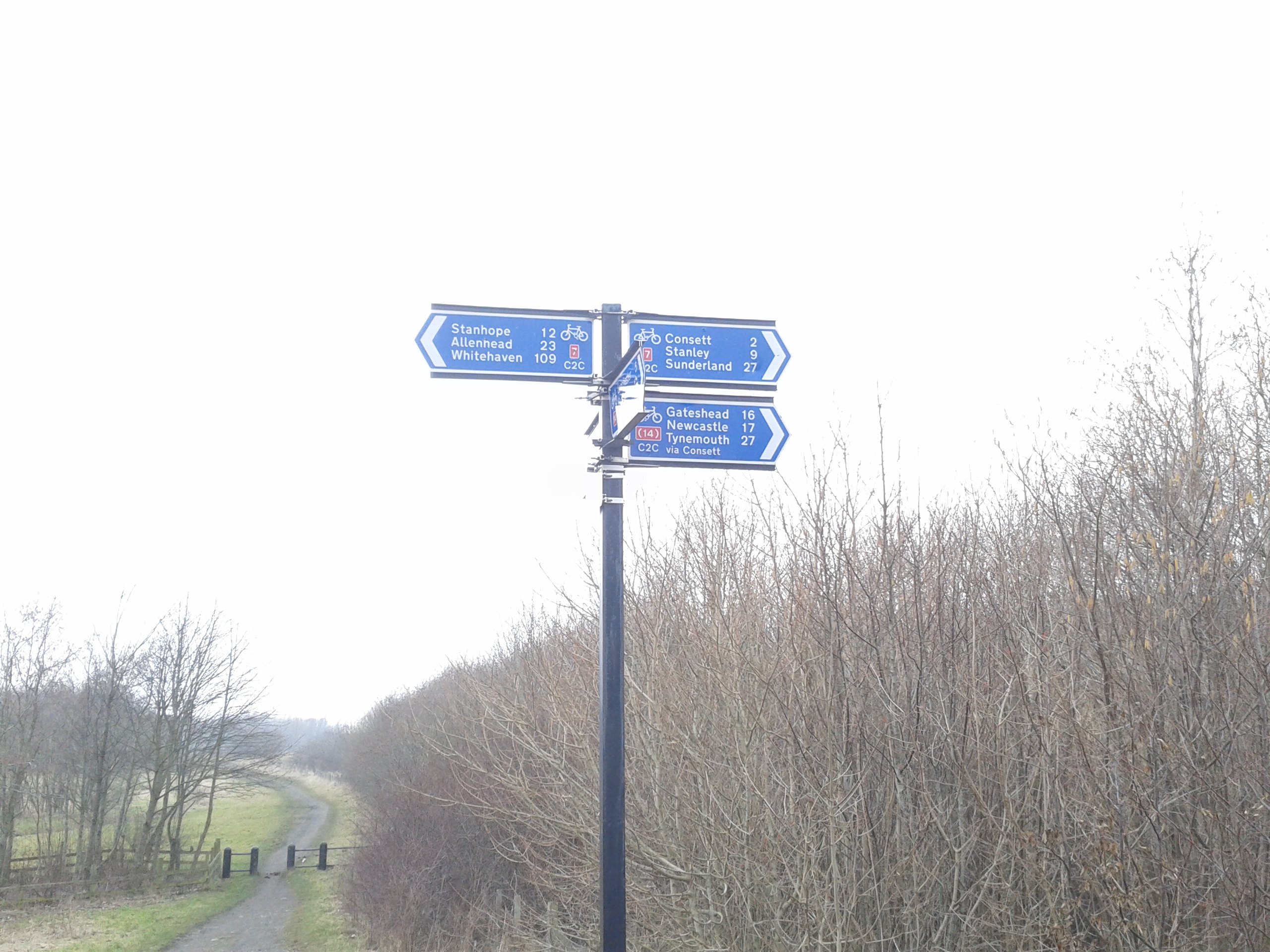
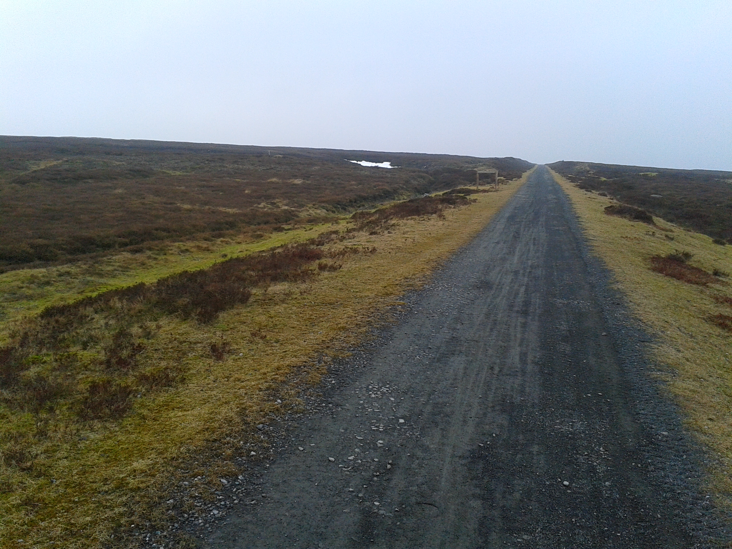
After wimping out yesterday from extending my Parkrun into a longer run it was time to sort out a run for today. After perusing options in the surrounding area (I find Bing maps’ ordnance survey option good for this), I settled on a section of something called the Waskerley Way with an out and return from its termination in Consett. I was aiming for something around the 15 mile mark but given the speed I run that was probably going to take me into darkness. My starting point was something of a confluence of cross country cycle routes and was known as “Lydgetts Junction”. As is the norm when running on a low carb diet I didn’t exactly feel full of energy starting out but I kept going enjoying the unknowns of a first time route. After about an hour I finally felt as if my legs were getting the fuel they were needing and I started running with what felt like a bit of a rhythm and a bit of bounce in the legs. As the trail hit the moors the views opened up and the degraded tarmac surface was replaced by a nice soft cinder track about the best running surface there is I reckon. I turned around at Hawkburn head and got back just before dark for a total of 13.29 miles (I won’t say how long that took though !). A nice run to celebrate 10kg of weight loss since the beginning of January.
Another trip down to Leeds and another opportunity to try a run somewhere a bit different. I knew I would be getting away a bit earlier so decided to head for the White Horse at Sutton Bank, the escarpment forming the western edge of the North York Moors with a particularly scenic section of the cleveland way running along the top. I got there for 3pm and despite clear and sunny weather in Leeds the escarpment was totally clagged in. C’est la vie I thought and climbed the 100 or so steps up from the carpark to reach the Cleveland Way Path (This nearly near enough killed me and I had to stop several times as I was feeling distinctly faint, no doubt a consequence of the virtual absence of carbohydrate stores in my body). Shuffling along I felt drained, with absolutely no energy but this is where the mindset of the long distance runner comes into play. “Imagine you are 80 odd miles into the NDW100 about to tackle Detling to Lenham, it will be pitch black, you will feel sh*te your body will be screaming at you to stop, but just keep going one foot after another, transend the physical and take your head to a higher plane” This did seem to work and slowly the sun started to bore its way through the thick mist, suddenly bursting through to reveal a fantastic vista. I was in awe and also extremely grateful for a reason to stop more than a few times to take some photos with my phone. Despite some muddy sections where I really needed trail shoes this was easily my best run so far this year. Just over 7 miles.
Unfortunately I have been off running for nearly 10 days after coming down with a severe cold triggered I think by not changing into enough dry clothes after my run at Spofforth. Still the weight has continued to come off and it was time to see if I was able to tackle my local Parkrun course again. It’s been a while since I have done this, despite my other half being a dedicated particpant. It felt good and I ran (so I felt) like the wind coming in at just over 25 mins for the 5k bang on 8 mins a mile pace. South Shields Parkrun
I am determined to up my running miles so planned a mid week run after a meeting that I was attending in Leeds, popping into a disabled toilet at the venue I was attending and reappearing fully kitted out. I had settled on a nice looking run from a place called Spofforth along a disused railway track dubbed the Harland Way a few miles to Wetherby with the idea that I would run 40 mins on the outward leg and then return. Starting out was pleasant despite the freezing weather and flurries of snow and the route was mainly in a cutting so sheltered from the wind. The cycle route signs disappeared in Wetherby town centre so I ended up just running randomly through the town as blizzards swirled about my pace slowing even more with the change in surface to pavement. It was good to get back to the car just as it finally got really dark. Nearly 7 miles in total.